Victoria Line Map
Updated: January 2025
The Victoria Line connects the north of the city with the south. It was named in honour of Queen Victoria.
Jubilee, Elizabeth and Victoria lines honour both the history and the monarchy of London.
Victoria Line maps
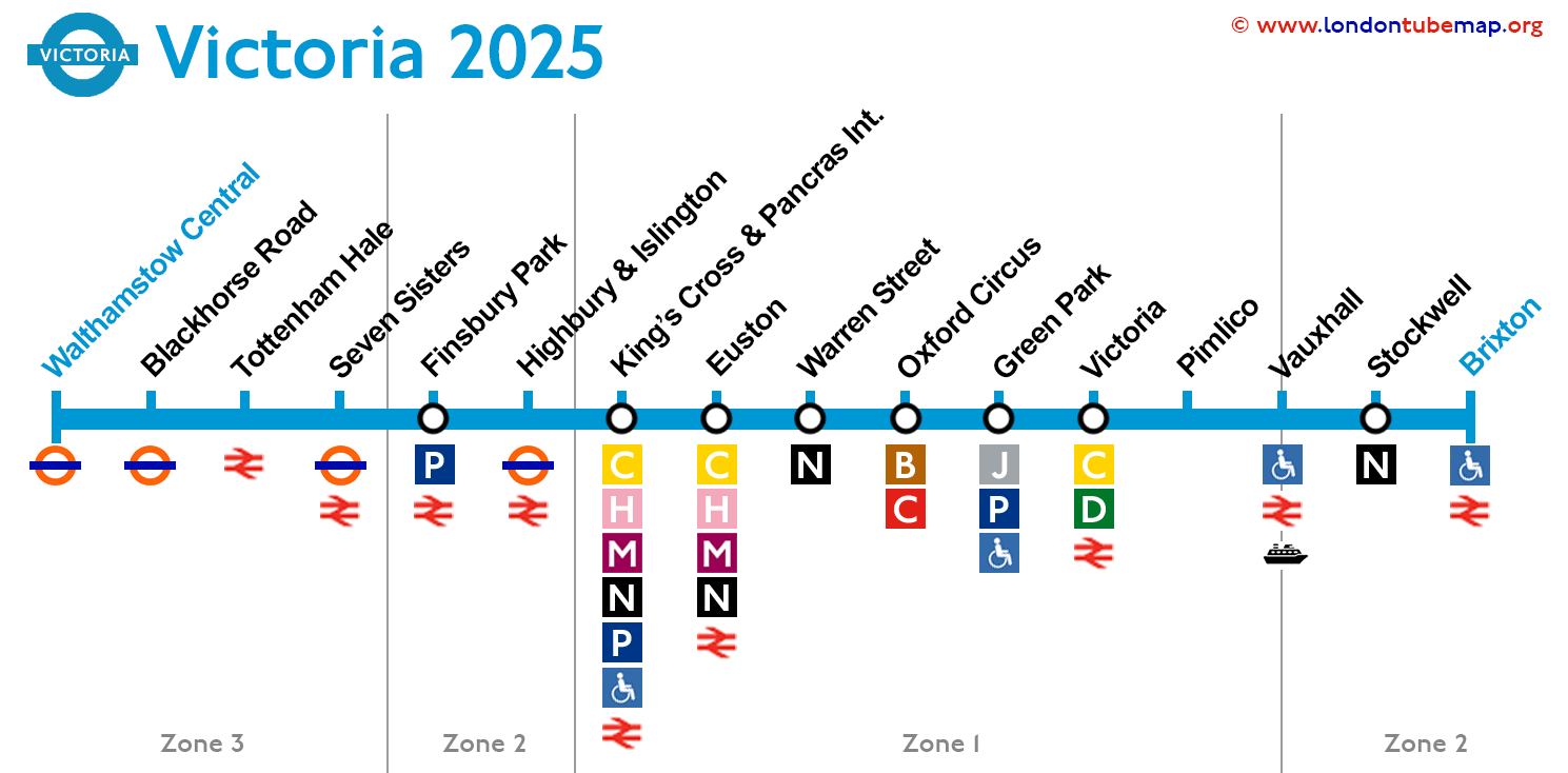
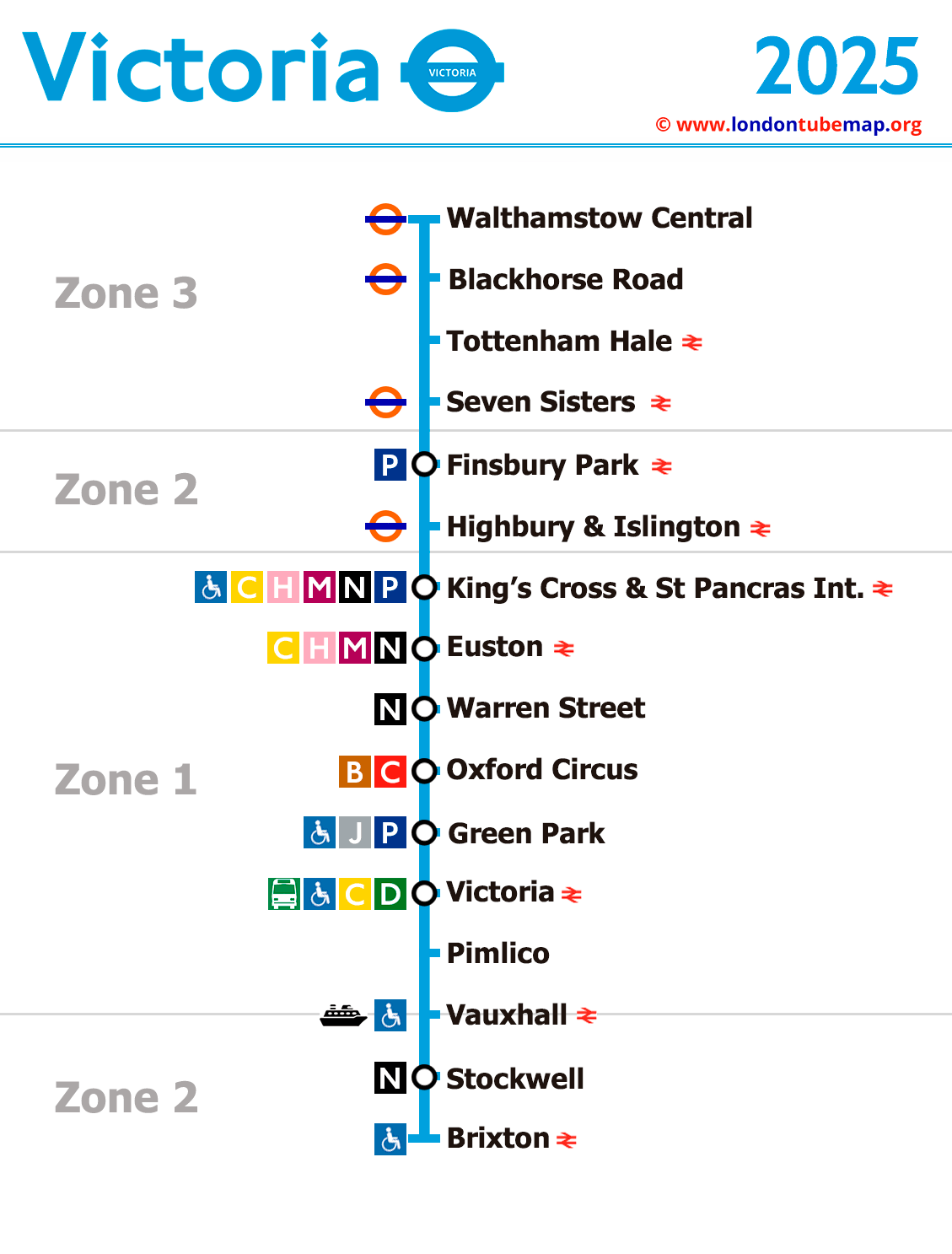
See the stations on the map below (January 2025).


Overview of this tube line:
- Opened in 1968.
- Colour: Light blue.
- Underground.
- 16 stations.
- 21 km (13 miles) long.
Should you wish to explore the entirety of the London Underground network, you are invited to view the comprehensive London Tube map. This resource includes a page where all lines are neatly presented together (yet distinctly separate), or you may opt to examine individual lines simultaneously.
List of Victoria Line Stations
Route Brixton - Walthamstow Central
This is a list of all Victoria Line stations from Brixton to Walthamstow Central.
| STATIONS | ZONE | INFO |
|---|---|---|
| Brixton | 2 | |
| Stockwell | 2 | |
| Vauxhall | 1/2 | |
| Pimlico | 1 | |
| Victoria | 1 | |
| Green Park | 1 | |
| Oxford Circus | 1 | |
| Warren Street | 1 | |
| Euston | 1 | |
| King's Cross St. Pancras | 1 | |
| Highbury & Islington | 2 | |
| Finsbury Park | 2 | |
| Seven Sisters | 3 | |
| Tottenham Hale | 3 | |
| Blackhorse Road | 3 | |
| Walthamstow Central | 3 |
London tube map | Timetable | Fares | All tube lines