Bakerloo Line Map
Updated: January 2025
The Bakerloo line was originally called the "Baker Street & Waterloo Railway" because of its route. Later the press and passengers began to call it Waterloo, from the combination of "Baker Street" and "Waterloo", and this name has survived up to the present.
Bakerloo Line
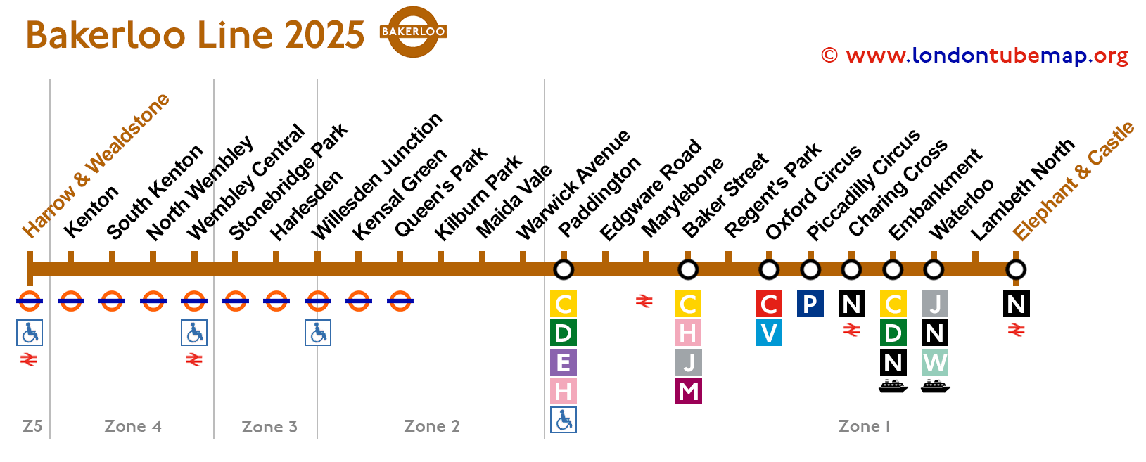
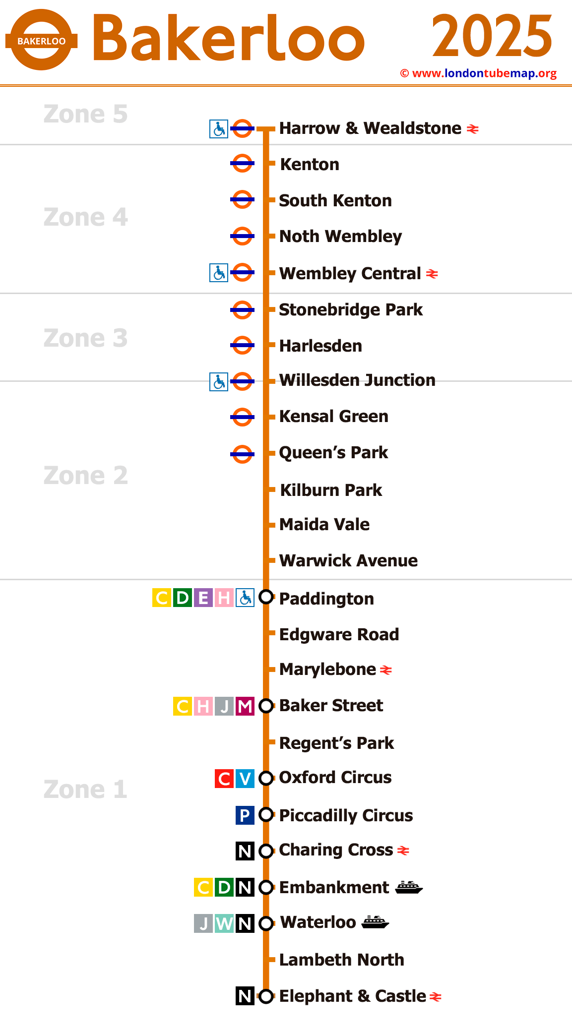
On the map below you will find all the stations of Bakerloo Line, the information was updated in January 2025.


Overview of this tube line:
- Opened in 1906.
- Colour: Brown.
- Underground.
- 25 stations (15 underground).
- 12 km (7.5miles) length of track.
If you want, you can view the entire London Tube map, one page with all the lines grouped together, or you can view each line separately.
London tube map | Timetable | Fares | All tube lines
List of Bakerloo line stations
Harrow & Wealdstone - Elephant & Castle
Here is the list of all Bakerloo line stations, which in total has 25 stops.
If you click on the name of the station, you can see real-time timetable information and more detailed info. If you click on the line icons, you will see information about that line and its transfers.
| STATIONS | ZONE | INFO |
|---|---|---|
| Harrow & Wealdstone | 5 | |
| Kenton | 4 | |
| South Kenton | 4 | |
| North Wembley | 4 | |
| Wembley Central | 4 | |
| Stonebridge Park | 3 | |
| Harlesden | 3 | |
| Willesden Junction | 2/3 | |
| Kensal Green | 2 | |
| Queen's Park | 2 | |
| Kilburn Park | 2 | |
| Maida Vale | 2 | |
| Warwick Avenue | 2 | |
| Paddington | 1 | |
| Edgware Road | 1 | |
| Marylebone | 1 | |
| Baker Street | 1 | |
| Regent's Park | 1 | |
| Oxford Circus | 1 | |
| Piccadilly Circus | 1 | |
| Charing Cross | 1 | |
| Embankment | 1 | |
| Waterloo | 1 | |
| Lambeth North | 1 | |
| Elephant & Castle | 1 |
London tube map | Timetable | Fares | All tube lines