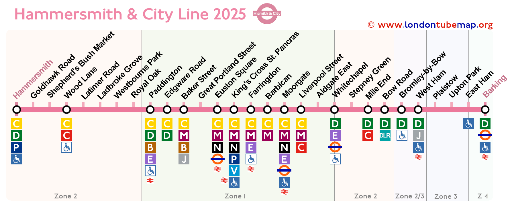
Mapa de la línea Hammersmith & City (línea rosa)
Actualizado: Enero 2025
La Línea Hammersmith & City, conocida por su distintivo color rosa, comparte varias estaciones con las líneas Circle y District. Esta línea es un enlace de transporte clave para los residentes del oeste de Londres, proporcionando un acceso conveniente al corazón de la ciudad.
Originalmente una parte de la Línea Metropolitan, la Línea Hammersmith & City se estableció en su forma actual en 1988. Sus estaciones están llenas de historia, formando parte de la red del Metropolitan Railway, el primer ferrocarril subterráneo del mundo, que comenzó sus operaciones en 1863.
Línea Hammersmith & City
Consulta las estaciones en el mapa a continuación a partir de Enero 2025.

Descripción general de esta línea de metro:
- Inaugurada en 1988.
- Color: rosa.
- Subterránea.
- 29 estaciones.
- 25 km (15.5 millas) de vía.
Si deseas explorar la totalidad de la red del Metro de Londres, te invitamos a ver el completo Mapa del Metro de Londres. Este recurso incluye una página donde todas las líneas están presentadas de manera ordenada (aunque claramente separadas), o puedes optar por examinar las líneas individuales simultáneamente.
Lista de estaciones de la línea Hammersmith & City
Aquí está la lista de las 29 estaciones de metro en la línea Hammersmith & City, si haces clic en el nombre de la línea verás más información como horarios en tiempo real.
Si haces clic en los iconos en la columna de "Info", puedes ver más detalles de la línea o del dibujo.
Ruta Goldhawk Road - Barking
| ESTACIONES | ZONA | INFO |
|---|---|---|
| Hammersmith & City (H&C line) | 2 | |
| Goldhawk Road | 2 | |
| Shepherd's Bush Market | 2 | |
| Wood Lane | 2 | |
| Latimer Road | 2 | |
| Ladbroke Grove | 2 | |
| Westbourne Park | 2 | |
| Royal Oak | 2 | |
| Paddington | 1 | |
| Edgware Road | 1 | |
| Baker Street | 1 | |
| Great Portland Street | 1 | |
| Euston Square | 1 | |
| King's Cross St. Pancras | 1 | |
| Farringdon | 1 | |
| Barbican | 1 | |
| Moorgate | 1 | |
| Liverpool Street | 1 | |
| Aldgate East | 1 | |
| Whitechapel | 2 | |
| Stepney Green | 2 | |
| Mile End | 2 | |
| Bow Road | 2 | |
| Bromley-by-Bow | 2/3 | |
| West Ham | 3 | |
| Plaistow | 3 | |
| Upton Park | 3 | |
| East Ham | 3/4 | |
| Barking | 4 |
Mapa del metro de Londres | Horarios | Tarifas | Todas las líneas de metro